Maps Selected from Technical Reports
Yellowstone Basin Average Annual Flow Accumulation
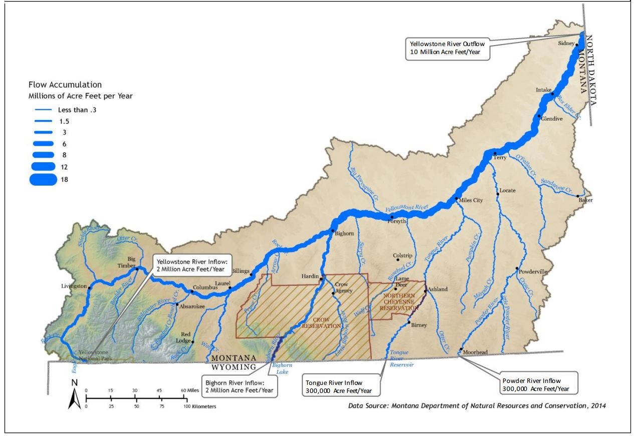 Map extracted from the "Yellowstone River Cumulative Effects Analysis," (Figure 4-15), US Army Corp of Engineers and the Yellowstone River Conservation District.
Major and Minor Diversions of the Yellowstone River
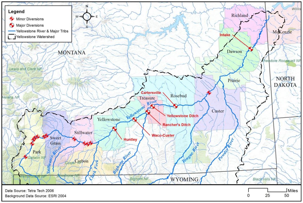 Map extracted from the "Yellowstone River Cumulative Effects Analysis," (Figure 4-20), US Army Corp of Engineers and the Yellowstone River Conservation District.
Yellowstone River mainstem USGS gaging stations
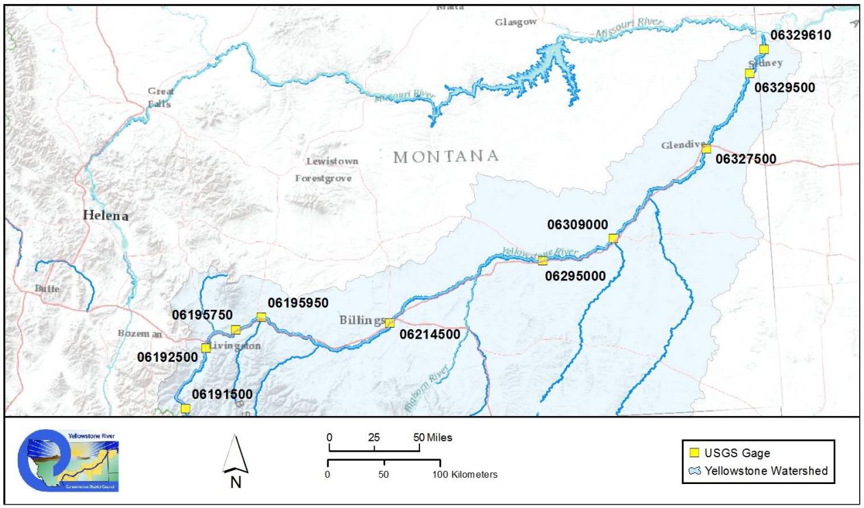 Map extracted from the "Yellowstone River Cumulative Effects Analysis," (Figure 4-90), US Army Corp of Engineers and the Yellowstone River Conservation District.
Public Water Supply Systems within 1-mile of the Yellowstone River mainstem
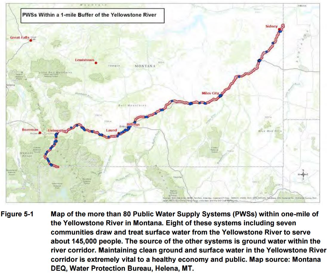 Figure 5-1 was extracted from the "Yellowstone River Cumulative Effects Analysis, Appendices: Study Reports and Datasets," US Army Corp of Engineers and the Yellowstone River Conservation District.
Yellowstone Clearinghouse Home
Yellowstone River Final Reports
- Cumulative Effects Analysis (CEA)
- CEA Technical Appendices
- CEA Executive Summary
- Reach Narratives
- Recommended Practices and Position Statements
- Governor's Upper Yellowstone Task Force (1997-2003)
Maps
- Online Map Viewer
- Reach Story Map 1: Overview
- Reach Story Map 2: Details
- Yellowstone Reference Maps
- Maps Selected from Technical Reports
Data and Technical Reports
- Imagery and Topographic Mapping
- Hydrology and Hydraulics
- Land Use and Physical Features
- Geomorphology
- Biology
- Socioeconomics
- List of Available GIS Data
Contact Info
