Imagery and Topographic Mapping
- Aerial Photos This page has links to historic air photos going back to the 1950s, recent photos taken for the Yellowstone River Conservation Districts Council, and our most current air photo collections of Montana.
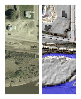
- Elevation Data
These are digital elevation model (DEM) and triangulated irregular network (TIN) data sets derived from LiDAR elevation point cloulds collected in 2004 and 2007. - Planimetric Feature Data
These data show locations of roads, streams, ponds, spot elevations, buildings, and other structures digitized from aerial photographs taken in 2004 and 2007, and elevation contour lines derived from the LiDAR data. - Government Land Office Survey Maps
This is a collection of 89 georegistered TIFF images of GLO township maps made between 1877 and 1906.
Yellowstone Clearinghouse Home
Yellowstone River Final Reports
- Cumulative Effects Analysis (CEA)
- CEA Technical Appendices
- CEA Executive Summary
- Reach Narratives
- Recommended Practices and Position Statements
- Governor's Upper Yellowstone Task Force (1997-2003)
Maps
- Online Map Viewer
- Reach Story Map 1: Overview
- Reach Story Map 2: Details
- Yellowstone Reference Maps
- Maps Selected from Technical Reports
Data and Technical Reports
- Imagery and Topographic Mapping
- Hydrology and Hydraulics
- Land Use and Physical Features
- Geomorphology
- Biology
- Socioeconomics
- List of Available GIS Data
Contact Info
