Planimetric Feature Data
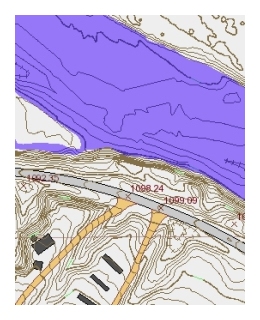 Planimetric data digitized from aerial photos includes contour lines, ponds, streams, roads, buildings, and other structures. Each link below is for an Esri personal geodatabase that contains the data for the river corridor in one county.
2004
- Stillwater
- Yellowstone (west half)
- Yellowstone (east half)
- Dawson
2007
Yellowstone Clearinghouse Home
Yellowstone River Final Reports
- Cumulative Effects Analysis (CEA)
- CEA Technical Appendices
- CEA Executive Summary
- Reach Narratives
- Recommended Practices and Position Statements
- Governor's Upper Yellowstone Task Force (1997-2003)
Maps
- Online Map Viewer
- Reach Story Map 1: Overview
- Reach Story Map 2: Details
- Yellowstone Reference Maps
- Maps Selected from Technical Reports
Data and Technical Reports
- Imagery and Topographic Mapping
- Hydrology and Hydraulics
- Land Use and Physical Features
- Geomorphology
- Biology
- Socioeconomics
- List of Available GIS Data
Contact Info
